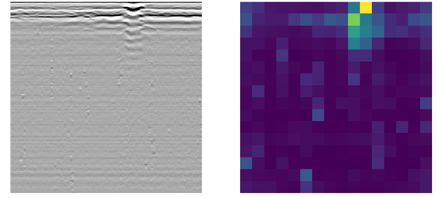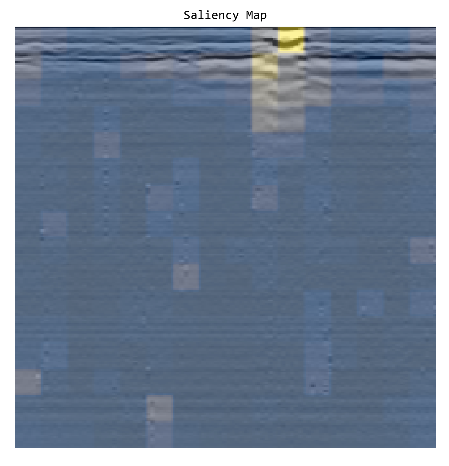
Geological exploration has long been a domain of meticulous study and analysis, where the subsurface secrets of the Earth are decoded from images that are as complex as they are enigmatic. One of the most powerful tools in this quest has been Ground Penetrating Radar (GPR), a technology that peers into the depths of the geological layers without a single shovel strike. But the interpretation of GPR data has remained a highly specialized skill — until now. Enter the Vision Transformer (ViT), a machine learning model that’s revolutionizing how we understand the hidden structures of the Earth.
The Synergy of GPR and ViT: A New Era of Subsurface Imaging
GPR has been indispensable in revealing the mysteries beneath our feet. By emitting high-frequency radio waves and measuring their reflections, GPR provides a glimpse into what lies below the surface. But the raw data it produces is a complex tapestry of signals that require expert interpretation. This is where ViT comes in.
ViT leverages the power of transformer models, originally developed for natural language processing, to interpret sequential data — only, in this case, the data is not text but images. By treating an image as a sequence of patches, ViT can apply the self-attention mechanism, assessing each patch in the context of its neighbors. This approach is tailor-made for GPR images, where understanding the relationship between different subsurface structures is key.
Transforming GPR Data into Geological Insights
The application of ViT to GPR data begins with the transformation of radar images into a series of patches. These are then fed into the ViT model, which uses its self-attention mechanism to analyze the entire context of the image. As the model processes through layers of attention, it learns to identify features of interest — be it faults in rock strata, buried artifacts, or the nuances of soil layers.
Real-World Applications: Where ViT Meets the Ground
The potential applications of ViT in geological radar image classification are vast. For archaeologists, it could mean the difference between finding a significant site or overlooking it. In civil engineering, it can pinpoint weaknesses in the subsurface before construction begins. In environmental science, it could track pollutants as they move through soil and rock. The list goes on.

Challenges and Future Horizons
The journey of integrating ViT with GPR is not without its challenges. Training a ViT model requires a substantial dataset, which in the case of geological images, can be difficult to obtain. Moreover, the model needs to be fine-tuned to accommodate the unique properties of GPR data.
However, the future is promising. As datasets grow and the model becomes more adept, the accuracy of ViT in classifying geological radar images is only expected to improve. This will open new doors in how we understand and interact with the geological foundation of our world.
Conclusion: A New Layer of Understanding
The fusion of GPR technology with Vision Transformer models is more than just a technological advancement — it’s a paradigm shift in geological exploration. By automating and enhancing the interpretation of GPR images, we stand on the brink of a new era where the subsurface secrets of our planet are not just visible but understandable to the machines we train. This partnership between human expertise and artificial intelligence holds the promise of deeper insights, safer constructions, and a more profound understanding of the Earth beneath our feet.